38.202876, -81.013769
38°12'10.4"N 81°00'49.6"W
End of road at Gauley river.
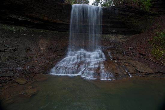
To get to Ramsey Branch Falls take U.S. 60 five miles west of its intersection with U.S. 19 to Saturday Road (GPS: 38.128491, -81.074095). Turn right (north) on Saturday Road and wind through the countryside of pastures and woods. After 6.9 miles turn left at the junction with Ramsey Branch Road and continue 1.1 miles to a right on Woods Ferry Crossing Rd. This is a NOT SO NICE dirt road that will take you down to the Gauley River. The last half mile is steep, rough, rocky, and requires a truck or 4WD vehicle with a high center. Turn right at a short side road just before the river and park. There is no trail that leads upstream to the falls so you will be getting wet. It's more like a creek walk of a ¼ mile or so. However, when you reach the amphitheater of Ramsey Branch Falls, you will be glad and I know you will stay awhile to revel in the beauty and solitude of this wonderful place.
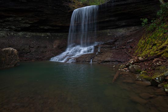
I recently learned of other falls above this one, but do not have access information at this time. As you can see from the image above, it doesn't appear to be accessible from this point.