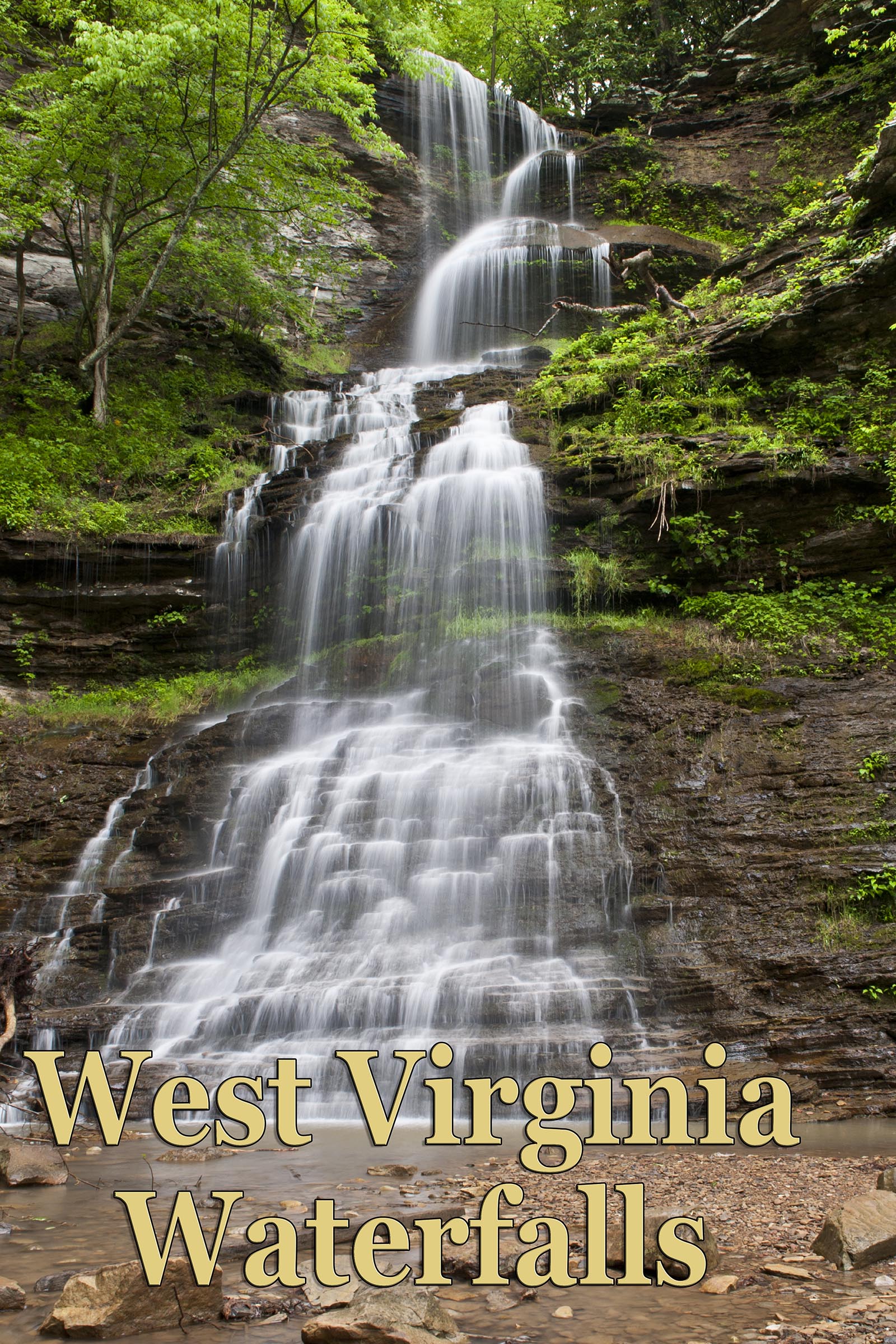
This is a BEGINNING ARTICLE. As I have never been to this place as yet, I will be doing more research and visiting this place beginning in Fall of 2021 and reporting back and updating this page at that time. If you have info to share please contact me.
Meadow River is a place I have thought about many times. It first came to my realization when I travelled the rail trail from Woods Ferry Crossing down near Ramsey Branch on out to Statton Branch to visit Confluence Falls. At that time we came upon one of the old rail tunnels which had been blocked off to traffic. We wandered in on foot a ways but not all the way through. This is close to the spot where the Gauley River and Meadow River come together.
I then looked at the map and decided there were surely falls in along the Meadow River on Dogwood, Hendricks, and Arrowwood Creeks along the south shore, especially Dogwood and Hendrics. The only issue was how to access the areas. Not sure of any trails on this side leading down to the river. Looking at the map, with terrain feature exposed, gives me the impression that the best way in on the south shoreline is to access from US 19, about four miles north of US 60. There also seems to be shoulder parking available south of the bridge -- just not sure of legalities. Not 100% sure about where you start, but Arrowwood Creek runs under the highway at this point. You can look at the map and decide how you might like to venture into this area. I know of several people who have gone down into the Dogwood Creek area.
Access to the north shore can be achieved by driving just north of the bridge crossing Meadow River and turning west on Underwood Rd. It's the first intersection after crossing the bridge. Look to your right for a parking area. Ed's article also says to then turn left on Dietz Rd. and park at a pullout at the curve at the top of the hill and hike down the dirt road that parallels US 19. At the fork go left (up stream) or right (down stream) depending on your preference. It is also quite obvious to anyone who drives this stretch of road often that people do park on the shoulder just north of the bridge on the southbound side on a regular basis. It's also clear that there is a trail along the guard rail that leads to the river. This is probably climbing access. So, you be the judge. Look at google earth.
My friend Ed Rehbien, who is an accomplished photographer, writer, and explorer in West Virginia, has given me permission to use some of his published work here. Have a look at this article that Ed wrote back in 2007 for the Wonderful West Virginia magazine. See Ed's website with links to all his work here.
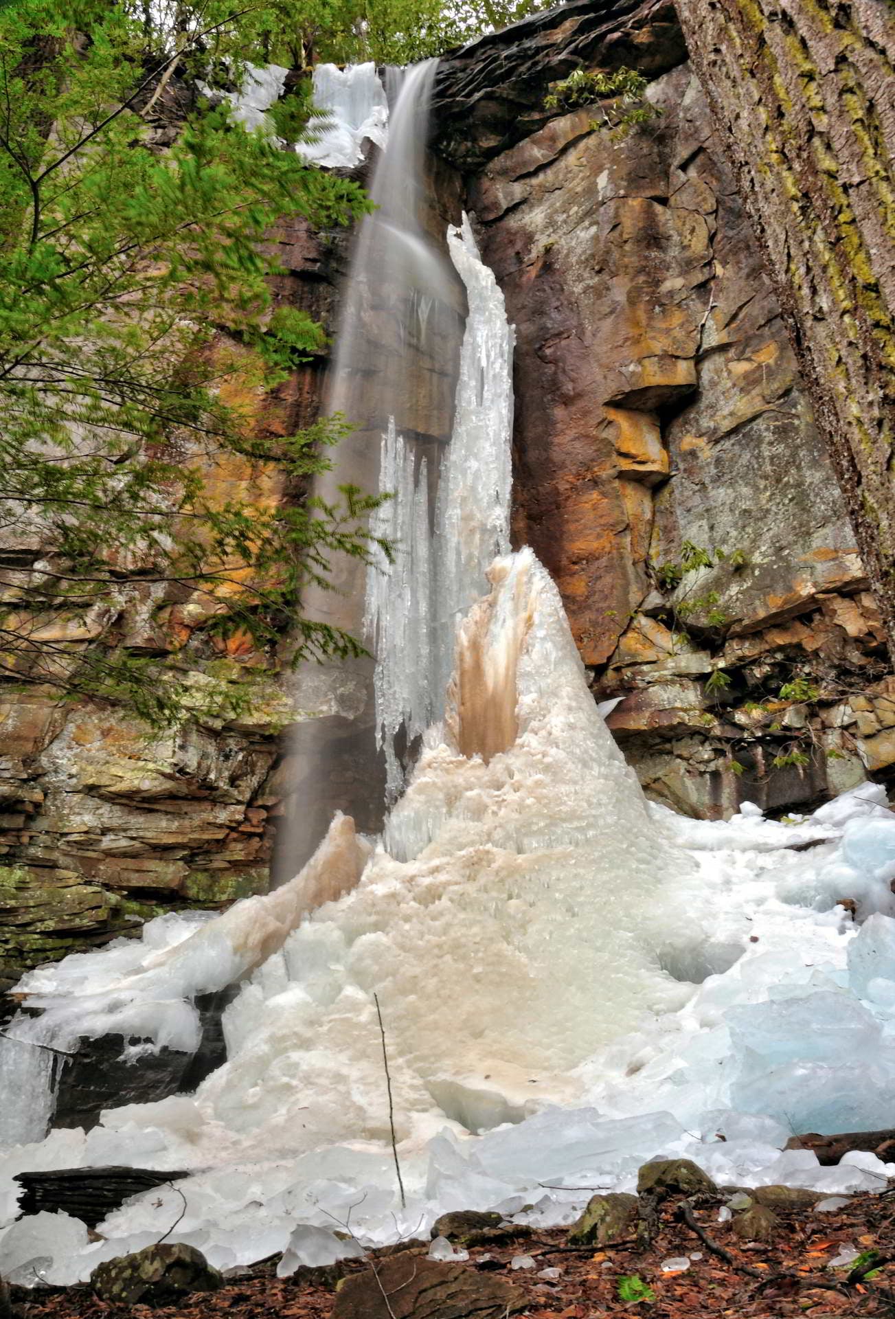
Here's a shot Ed took of one of the wet weather falls to be seen along the cliffs in the Meadow river. It's called Sonnet Falls. Not sure of the exact location yet.
This article copied from "New River Climbing".
What We Know:
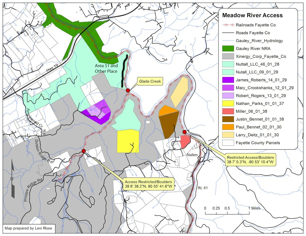
Land ownership along the South side of the Meadow is a complex mish-mash of different stake holders that has been in a constant state of change. Simply determining who placed the boulders and who owned the different parcels of land was a challenge in its own right. After some research, Fayetteville climber and GIS specialist, Levi Rose, compiled a map (below) that offers some insight into the land ownership, as well as the location of the road blocks and the affected cliff line. The road blocks are indicated as red dots. There are three: one at the entrance to the railroad grade near Nallen, one along the railroad grade just downstream of the intersection with Propp’s Ridge Rd, and one that blocks both the trestle and the road over the top of the waterfall along Propp’s Ridge Rd.
The road blocks were placed by The Forestland Group, a timber investment management organization. They continue to manage the property, but have sold the mineral rights of nearly 11,000 acres, including the Propp’s Ridge access road, to a coal company called Xinergy Corp. Talks with the Forestland Group revealed that restricting vehicular access and recreational use was done at the request of their insurance company due to liability concerns. This closure is not directed specifically at climbers, but at all recreational user groups. Forestland Group has been continuously open and receptive to working with NRAC and has indicated that the potential for future recreational use on their land is a possibility. Currently, hiking, biking, and climbing on their property is considered trespassing and signs are clearly posted.
Later discussion with the County Commission revealed that the railroad grade along the Meadow River is part of a “Rails to Trails” land easement held by Greenbrier and Fayette Counties. This 2012 purchase was made possible with over $435,000 of grants secured for the project by the West Virginia Department of Highways and the National Park Service. More details on the acquisition of the Rails to Trails corridor can be read here.
What It Means For Climbers
Vehicular access to the Southside crags is quite likely gone for good. Hiking in from the road block at the waterfall on Propp’s Ridge Rd cuts directly through Forestland property and would be considered trespassing. The railroad grade that parallels the river, on the other hand, is completely open to hiking and biking along its entire length. However, stepping off the side of the road to hike, fish, or climb, throughout the portion upstream of the intersection with Propp’s Ridge Rd, would be considered trespassing. The land neighboring the railroad grade downstream of the road block near the intersection with Propp’s Ridge Rd. is not on Forestland property.
The cliffs located on Forestland property are: Rehab Crag (not included in any guidebook), High Density Feed Lot and Congo (2nd edition guidebook only), and Mud Hueco.
The Brilliant Pebble, Area 51, The Other Place, Hedrick’s Creek, and Orange Wall are not located on Forestland Property.
What To Do
Working with the Forestland Group and other land managers to find a legitimate and user-friendly access alternative will not be a quick and easy process. That said, we have faith that solutions to these challenges can be worked out. In the interim, we know that climbers are a resourceful bunch. If the climbing is good enough, climbers will find a way to get there. For now, the most legitimate way to access the crags along the South side of the river that are not on Forestland property is to park off of Dietz or Underwood Road as you would for the Lower and Upper Meadow. Hike down to the river, take your shoes off and get wet! Once on the other side of the river, Area 51 and the Other Place are about 2.5 miles upstream and Orange Wall is about 2 miles downstream. These areas are still within an easy and flat one hour hike of the car. It should go without saying that the Meadow River can be quite dangerous, or impossible, to cross at high water. Use your judgment!
Remember that YOU are the New River Alliance of Climbers. Our motto is “Get Involved, Be Informed, Stay Connected.” We’ll do our best to keep you updated on the evolving changes and we encourage everyone to stay informed and share the info with others. Please use your best judgment when accessing these areas and remember that your actions could affect our large community of climbers. Have fun out there!